


Oakham Precinct 1, Worcester County, Massachusetts
About
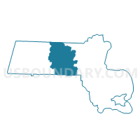
Outline

Summary
| Unique Area Identifier | 595535 |
| Name | Oakham Precinct 1 |
| County | Worcester County |
| State | Massachusetts |
| Area (square miles) | 21.22 |
| Land Area (square miles) | 20.83 |
| Water Area (square miles) | 0.39 |
| % of Land Area | 98.17 |
| % of Water Area | 1.83 |
| Latitude of the Internal Point | 42.35086150 |
| Longtitude of the Internal Point | -72.04424800 |
Maps


Graphs
Select a template below for downloading or customizing gragh for Oakham Precinct 1, Worcester County, Massachusetts


Neighbors
Neighoring Voting District (by Name) Neighboring Voting District on the Map
- Barre Precinct 2, Worcester County, MA
- New Braintree Precinct 1, Worcester County, MA
- North Brookfield Precinct 1, Worcester County, MA
- Paxton Precinct 1, Worcester County, MA
- Rutland Precinct 1, Worcester County, MA
- Spencer Precinct 3, Worcester County, MA
Top 10 Neighboring County Subdivision (by Population) Neighboring County Subdivision on the Map
- Spencer town, Worcester County, MA (11,688)
- Rutland town, Worcester County, MA (7,973)
- Barre town, Worcester County, MA (5,398)
- Paxton town, Worcester County, MA (4,806)
- North Brookfield town, Worcester County, MA (4,680)
- Oakham town, Worcester County, MA (1,902)
- New Braintree town, Worcester County, MA (999)
Top 10 Neighboring Unified School District (by Population) Neighboring Unified School District on the Map
- Wachusett School District, MA (41,346)
- Quabbin School District, MA (15,671)
- Spencer-East Brookfield School District, MA (13,871)
- North Brookfield School District, MA (4,680)
Top 10 Neighboring State Legislative District Lower Chamber (by Population) Neighboring State Legislative District Lower Chamber on the Map
- First Worcester District, MA (45,834)
- Fifth Worcester District, MA (40,928)
- Thirteenth Worcester District, MA (40,553)
Top 10 Neighboring State Legislative District Upper Chamber (by Population) Neighboring State Legislative District Upper Chamber on the Map
- First Worcester District, MA (165,038)
- Worcester, Hampden, Hampshire & Franklin District, MA (163,941)
Top 10 Neighboring 111th Congressional District (by Population) Neighboring 111th Congressional District on the Map
- Congressional District 3, MA (664,919)
- Congressional District 2, MA (661,045)
- Congressional District 1, MA (644,956)
Top 10 Neighboring Census Tract (by Population) Neighboring Census Tract on the Map
- Census Tract 7211.02, Worcester County, MA (7,973)
- Census Tract 7261, Worcester County, MA (5,988)
- Census Tract 7221, Worcester County, MA (5,398)
- Census Tract 7271, Worcester County, MA (4,806)
- Census Tract 7251, Worcester County, MA (4,680)
- Census Tract 7231, Worcester County, MA (3,989)
- Census Tract 7211.01, Worcester County, MA (1,902)
Top 10 Neighboring 5-Digit ZIP Code Tabulation Area (by Population) Neighboring 5-Digit ZIP Code Tabulation Area on the Map
- 01562, MA (11,688)
- 01543, MA (7,973)
- 01005, MA (5,079)
- 01612, MA (4,845)
- 01535, MA (4,680)
- 01068, MA (1,902)
- 01531, MA (999)